-
Hashtag= #alignthestars
Background
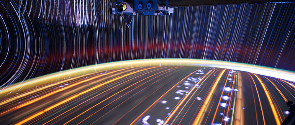
The ISS Crew members took thousands of frames of time lapse photography of aurora, in addition to other features, which have star fields visible in the background. Aligning the stars in the ISS crewmember aurora imagery is needed to determine the area of the Earth that the aurora is covering. Identifying the star fields will enable creative displays of the imagery and also “fit” it into the puzzle of the aurora ring. Scientists can then use the ISS imagery as a more integral part of their data set for studying the aurora and its impact on Earth. Comparisons of aurora activity over the same areas of the Earth may reveal local effects in the magnetic field, similar to scientists studying local effects of topography on weather clouds.
Challenge Description:
Create an app to match and align the stars in the aurora imagery taken from the ISS. Using the stars, the nadir point (spot over the Earth), and the altitude of the ISS when the image(s) was taken, overlay and display the aurora in context with the NOAA aurora oval for that day and time.
Functional Specifications:
The app needs to be able to take images from the Gateway to Astronaut Photography of Earth Website; for this app development session the time lapse imagery frames are already available in downloadable zip files. Selected “video” links are available in the Resource section, along with a data table for those imagery frames which include the nadir and altitude data. (Our next website upgrade will make it easier for apps to download individual frames; this may be an apps challenge for the future)
- Match the star field to the star field in Stellarium planetarium software.
- Using the defined star field, the ISS location over the Earth (nadir point) and the ISS altitude display the area of the aurora image over the Earth.
- Display the NOAA aurora oval using Stellarium.
- Overlay the ISS aurora area over the NOAA aurora oval image in Stellarium.
- Let the knowledge grow!
Datasets
-
Still Imagery
http://eol.jsc.nasa.gov/Videos/CrewEarthObservationsVideos/Videos_Aurora.htm<p>Scroll down to “Towards Aurora Australis” (posted 2012/06/004)(Frames: ISS030-E-277933- ISS030-E-278379). Download the still imagery frames used to make the “videos”, the link is under the displayed image. These images were taken on April 25, 2012 between 20:03:19 & 20:11:51 GMT.</p>
<p>Scroll down to “Heading Towards Aurora Australis” (posted 2012/04/09). (Frames: ISS030-E-141370 through ISS030-E-142341) The images were taken on Mar 10, 2012 between 14:49:58 & 15:06:09 GMT. See the associated data sheet containing the data set described in data set #1.</p>
<p>Scroll down to “Aurora Borealis over the Great Lakes and Canada” (posted 2012/03/15)(Frames: ISS030-E-102170 through ISS030-E-102477). The images were taken on Jan 25, 2012 between 09:27:08 & 09:32:16 GMT. See the associated data sheet containing the data set described in data set #1.</p>
<p>Scroll down to “Aurora Borealis over Eastern North America” (posted 2012/05/30)(Frames: ISS030-E-232972 through 233320). The images were taken on April 13, 2012 between 05:54:35 & 06:00:23 GMT. See the associated data sheet containing the data set described in data set #1.</p> -
Stellarium
http://www.stellarium.org/Stellarium is a free open source planetarium for your computer. It shows a realistic sky in 3D, just like what you see with the naked eye, binoculars or a telescope.
Create Project Solving this Challenge
Need help?
Check out the comments to chat with other users working on this challenge or email the challenge creator with any questions.
-
The following projects are solving this challenge:
-
stardust
This project will use computer vision techniques such as image stitching and pattern recognition to realize a star map matching. The project will use the image frames to realize the map stitching and the additional data to present a context that could be visualized by any human using the Sollariu... Visit Project
-
line-up
Use computer vision techniques for matching stars in ISS photos Visit Project
-
Aurora Localization via Starfields
## Method Steps Using images of the aurora taken from the ISS, we find location of the aurora over the Earth, by the following method: 1. Segment (using k-means) to get the ground, sky, and aurora. 2. Filter resulting images to only get the brightest stars, and generate star-trail images ... Visit Project
-

Aligning the Stars
Loading...
×
Loading...
×